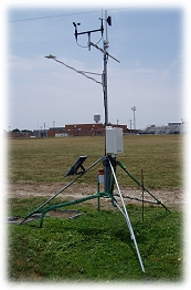

Versailles, Missouri
Versailles, Morgan
Online - July 8, 2026, 7:35 pm CDT
Versailles is currently down.
Data is currently unavailable due to technical difficulties. We are currently working on getting this issue fixed. We apologize for the inconvenience.
Current Conditions (updated every 5 minutes)
Summary
Time:
5:55 pm
4:30 pm
Time:
5:35 am
6:30 am
Time:
11:45 am
12:35 pm
Morgan County Forecast
This Afternoon:
Sunny, hot. Near steady temperature in the upper 80s. Southwest winds around 5 mph.
Tonight:
Mostly clear. Humid with lows in the lower 70s. South winds around 5 mph.
Thursday:
Partly sunny. A slight chance of showers and thunderstorms in the morning, then a chance of showers and thunderstorms in the afternoon. Hot with highs around 90. Southwest winds around 5 mph. Chance of rain 30 percent.
Thursday Night:
Mostly cloudy with a chance of thunderstorms. A chance of showers. Humid with lows in the lower 70s. Southeast winds around 5 mph. Chance of rain 50 percent.
¹ Since midnight | ² Ice or snow not recorded | ³ Short crop | * Bare Soil
More info about the station