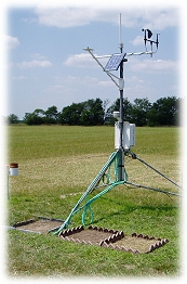

Green Ridge, Missouri
Green Ridge, Pettis
Online - June 9, 2026, 12:45 pm CDT
Close
Green Ridge is currently down.
Data is currently unavailable due to technical difficulties. We are currently working on getting this issue fixed. We apologize for the inconvenience.
Current Conditions (updated every 5 minutes)
Temperature:
Dew Point:
Heat Index:
Humidity:
Today's Precipitation:¹²
Wind Speed:
Peak Wind Gust:
Wind Dir:
NNE
Baro. Pressure:
29.94 in. ↑
Summary
Today:¹
Yesterday:
Max Temp:
Time:
Time:
89.1°F
11:25 am
11:25 am
82.9°F
4:47 pm
4:47 pm
Min Temp:
Time:
Time:
68.3°F
1:48 am
1:48 am
69.8°F
2:34 am
2:34 am
Precipitation:²
0.23 in.
0.00 in.
Peak Wind Gusts:
Time:
Time:
43.5 MPH
2:24 am
2:24 am
21.1 MPH
1:57 pm
1:57 pm
Estimated ET:³
0.15 in.
Avg Soil 2 Temp:*
75.7°F
Sunrise:
Sunset:
Pettis County Forecast
..Heat Advisory In Effect Until 10 Pm Cdt This Evening:
Rest Of Today:
Mostly sunny. Highs in the lower 90s. Southwest winds 10 to 15 mph with gusts up to 25 mph. Heat index values up to 108.
Tonight:
Mostly clear. Lows in the mid 70s. South winds 10 to 15 mph. Heat index values up to 107 early in the evening.
Wednesday:
Mostly sunny. Highs around 90. Southwest winds 15 to 20 mph with gusts up to 35 mph. Heat index values up to 102 in the afternoon.
¹ Since midnight | ² Ice or snow not recorded | ³ Short crop | * Bare Soil
More info about the station